Lane County Butterfly Club – Field Trips
Know Before You Go
Preregistration for Field Trips is required
The Lane County Butterfly Club of NABA will offer educational field trips in the greater Lane County Region,Central Cascades, and Ochocos. Our field trips often take place in rough or slippery terrain, so proper dress and footwear are essential. NABA field trips may be strenuous or hazardous. The weather and trail conditions can be unpredictable. Participation is at your own risk. Be prepared to sign a release form indicating this. You can view a sample copy of the release form (PDF format*). Please remember to bring water, lunch (for most trips), and protective sun/weather clothing, sunscreen, and good hiking shoes.
Pre-registration is done per event. See event details for more information on how to register. If you have any questions, please contact Sharon Blick at [email protected]

Field Trips
*2024*

Date & time:
Saturday, June 15, 2024 – 1:00 to 3:00 pm
Name & Lead:
“Learn to Count Butterflies”, led by Sharon Blick and other officers
Location:
Parks in the Eugene area
Description:
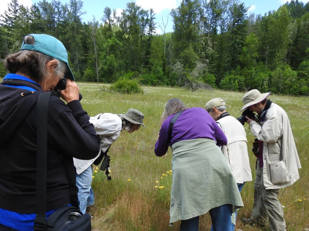
Come learn how to observe, photograph, catch, identify, and count butterflies in the field. This field trip will take place at one or more locations within the Eugene Butterfly Count circle, possibly including Mt. Pisgah, Spencer Butte, and the West Eugene Wetlands. We will send a small group with an experienced leader to each location as a practice session for the Eugene Butterfly Count on July 6.
Registration:
Closed
Cost:
FREE
Physical Effort:
Low to Medium
Date & Time:
Saturday, June 29, 2024 – All Day, Exact time and meeting location *To Be Announced*
Name & Lead:
“Ochoco Butterfly Count“, led by Sue Anderson, 35th year
Location:
Ochoco National Forest near Prineville
Description:
We will meet at a campground in the Ochoco National Forest about 15 miles east of Prineville and split into two groups. One group will go north and one will go south, meeting up at the Crooked River Bridge. Each group will drive to a number of locations and tally butterflies seen at each stop. If enough people participate, a hike to the top of Lookout Mountain can be included.
Pre-registration required. More details about location and time will be released to registered participants prior to the event.
Registration:
Register here through June 26. After that, call or text Sue at 541-480-0330
Cost:
$3.00 per person
Physical Effort:
Low to Medium
Date & Time:
Saturday, July 6, 2024, 10am – 3:00pm: Exact time and meeting location *To Be Announced*
Name & Lead:
“Eugene Butterfly Count”, led by Sharon Blick, 34th year
Location:
Mt Pisgah, Spencer’s Butte, Amazon Park, West Eugene Wetlands, and Eugene area parks
Description:
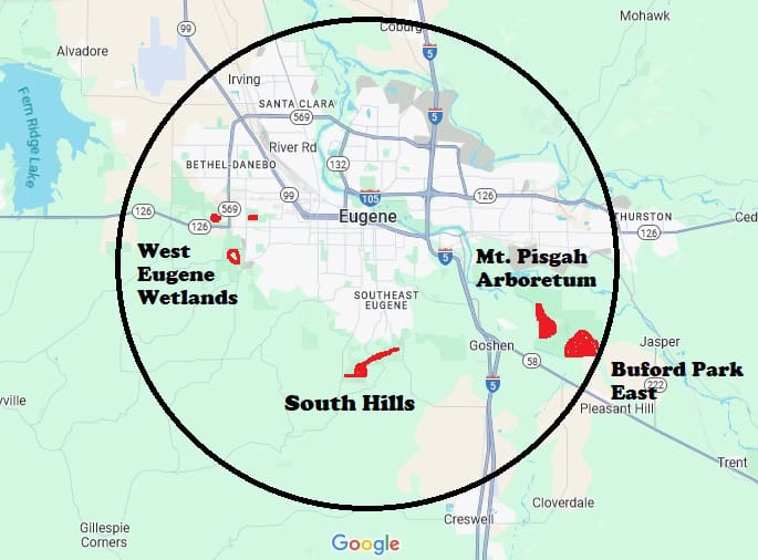
The Eugene count circle is centered at Amazon Park. We divide into four groups and send one group to each of the following areas: South Hills, Buford Park East, Mt Pisgah Arboretum, and West Eugene Wetlands. Each group will walk at least 3 miles and possibly up to 5 miles. South Hills has the steepest trails and the West Eugene Wetlands is the flattest.
Pre-registration required. More details about location and time will be released to registered participants prior to the event.
Garden Watchers: If you live within the Eugene Count Circle (see map) and have a yard where you can watch for butterflies, you can participate as a Garden Watcher. You will keep track of how many hours you spend watching and report the highest number of butterflies of each species that you see at one time. If you sign up in advance, we will send you more info and a report form. There is no cost to be a Garden Watcher.
Physical Effort:
Low to Medium
Date & Time:
Saturday, July 13, 2024 – All Day, Exact time and meeting location *To Be Announced*
Name & Lead:
“Metolius Butterfly Count”, led by Sue Anderson 39th year
Location:
Camp Sherman area
Description:
We will meet at a campground between Black Butte Ranch and Sisters, split into two groups and drive to the Camp Sherman area. One group will go to the east of the Metolius River and the other group to the west. Each group will drive to a number of locations and tally butterflies seen at each stop. If enough people participate, a hike to the top of Black Butte can be included.
Pre-registration required. More details about location and time will be released to registered participants prior to the event.
Physical Effort:
Low to Medium
Date &Time:
Saturday, July 20, 2024, All Day, Exact time and meeting location *To Be Announced*
Name & Lead:
“Browder Ridge Butterfly Count”, led by Neil Bjorklund, 24th year
Location:
Frissell Ridge and Iron Mountain
Description:
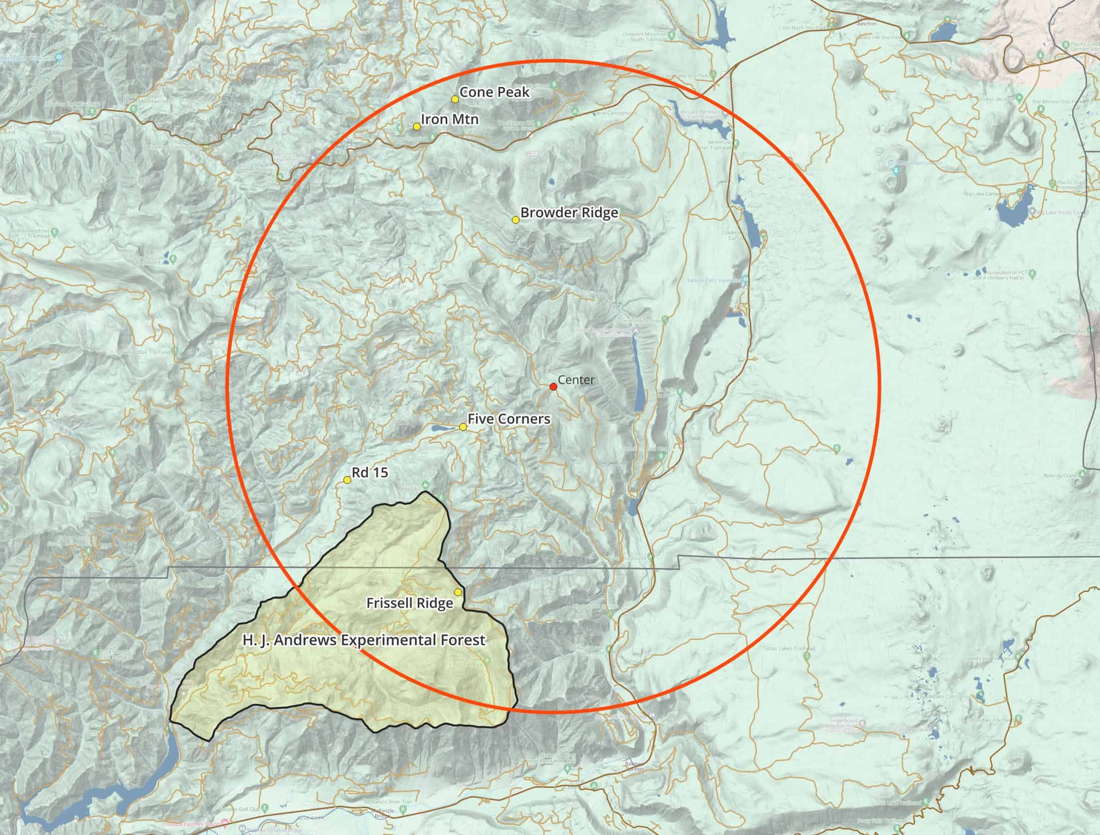
We will have two groups leaving Eugene in the early morning. One group drives 2 hours to the Iron Mountain trailhead and hikes to the top, a 2.4 mile hike of moderate difficulty. Sometimes this group splits in half to do both Iron Mountain and Cone Peak. The other group drives for an hour to a Forest Service Road near Blue River. Normally, this group drives to a number of locations on Frissel Ridge and tallies butterflies seen at each stop. In 2023, the route we normally count along Frissel Ridge was burned in a wildfire, so that road is now closed and will likely not open before our count this year. There are other roads in the circle where we can count, or we could have a group hike the Browder Ridge Trail or the Robinson Lake Trail, both of which have been done on earlier counts. Typically counters return to Eugene around 7 pm. Browder Ridge map
Physical Effort:
Low to moderate